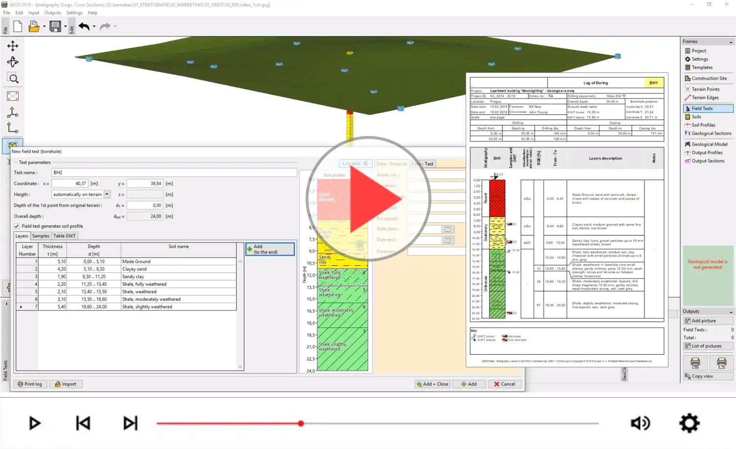
Moduł GEO5 Stratygrafia - Karty zawiera wiele predefiniowanych szablonów kart do różnych badań polowych. W GEO5 użytkownik ma swobodę tworzenia niestandardowego szablonu zgodnie z wymaganiami projektu, normami i/lub lokalnymi zwyczajami.
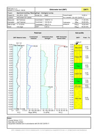
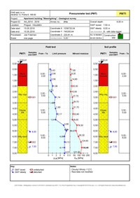
Otwór wiertniczy
- Badania polowe
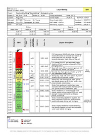
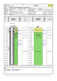
Otwór wiertniczy
- Profil gruntowy
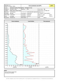
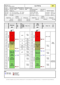
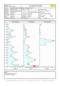
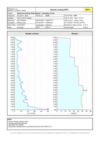
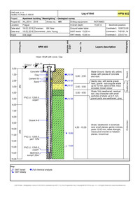
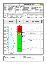
CPT - Badanie polowe
CPT - Profil gruntowy
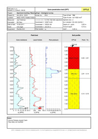
CPTu2 - Badanie polowe
CPTu2 - Profil gruntowy
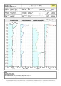
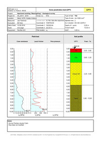
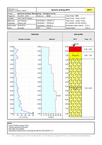
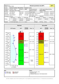
DMT - Badanie polowe
DMT - Profil gruntowy
DPT - Badanie polowe
DPT - Profil gruntowy
Studnia - Badanie polowe
Studnia - Profil gruntowy
Studnia-2 - Badanie polowe
Studnia-2 - Profil gruntowy
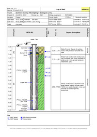
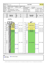
PMT - Badanie polowe
PMT - Profil gruntowy
SPT - Badanie polowe
SPT - Profil gruntowy
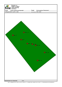
Strona podsumowania
projektu (Niemcy)
Zachęcamy do obejrzenia krótkiego filmu na temat tworzenia raportów geologicznych za pomocą modułu Karty w programie GEO5 Stratygrafia 3D.